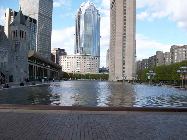
Bridging the Gap: Boston
Christian Science Center
Artifacts, Layers, Traces, and Trends
Site | Natural Processes | Site Through Time | Traces and Trends | Story | Home


Site boundaries today (Massachusetts Avenue, Huntington Avenue, Belvidere Street)


1914 (top) and 1937 (bottom) Sanborn fire insurance maps
Source: MIT Libraries online catalogue

Introduction

The site of the Christian Science Center went through a series of transformations over the course of the last century and a half that resulted in its current appearance. Changes in land use over time were the main drivers that caused the site to look differently over the decades. Far from being the strictly institutional place that it renowned for today, the site started out as a strictly residential location that housed middle-to-low income families in apartments and French flats starting in the 1870s. It then became a residential-commercial-institutional area until the 1990s when all was torn down and only the church and its affiliated buildings remain. During that time, the site was also home to restaurants, a theater, a telecommunications company, a hotel, and some streets that cut through which are no longer present today. Traces from the past however still remain on site, despite the disappearance of these buildings. This paper aims to elaborate on some of these trends by using illustrations taken at the site and comparing some of these findings with the older maps in order to understand the nature of these remains and what they mean for the past, present, and future. The site will be investigated one block at a time mainly in reliance on the 1914 and 1937 Sanborn maps which best represent the majority of the buildings throughout time.

Belvidere Street

Walking down Belvidere Street today, several artifacts, layers, traces, and trends form the past can be seen. Of the Sanborn maps used in the previous assignment, the 1937 map encompasses all the earlier buildings that were once present on that street. Starting at the intersection with Massachusetts Avenue, the current building looks more modern than the rest of the buildings along the rest of the street illustrating that the previous buildings there were torn down and the McDonald’s building was built. The Sanborn map shows a small alley, St. Cecilia Street which is still present today and cuts through the first building on Belvidere Street. The gap created by St. Cecilia Street is still present today, and it leads to the back-door entrance of several apartments on Belvidere Street. These apartments, once inhabited by several families in the early 1900s, are no longer home to as many people. No people were seen entering or leaving these buildings, however certain traces of residents were found. For example, an air conditioning unit was installed on one of the lower floor windows indicating that someone had resided in this apartment after World War II, since that’s when air conditioners became popularly used in public houses. Other signs of life in these apartments are recycling bins that are seen on their back-door exits with old grocery bags and pizza boxes in them. Graffiti is a recurring theme on the walls of old apartments and buildings on site, and while it is not a clear sign that people still reside in these old apartments, it indicates that these apartments are not always deserted. A layer from the past can be seen on the street itself where the side streets of the alley are made of brick and the center is a flat unpaved street, and since the brick at the bottom of the building doesn’t line up with street level and the building looks like it’s “buried” below the street, then the unpaved street was probably the initial layer and the brick was later added.


shot of the side of a deserted red brick building on St. Cecilia Street, notice difference in street material between brick and unpaved road


broken glass windows of deserted flats on Belvidere Street, graffiti covering windows


window air conditioning unit installed into one of the apartments post World War II


Recycling bin boxes outside the back entrance doors of some old apartments

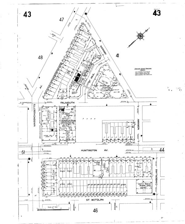
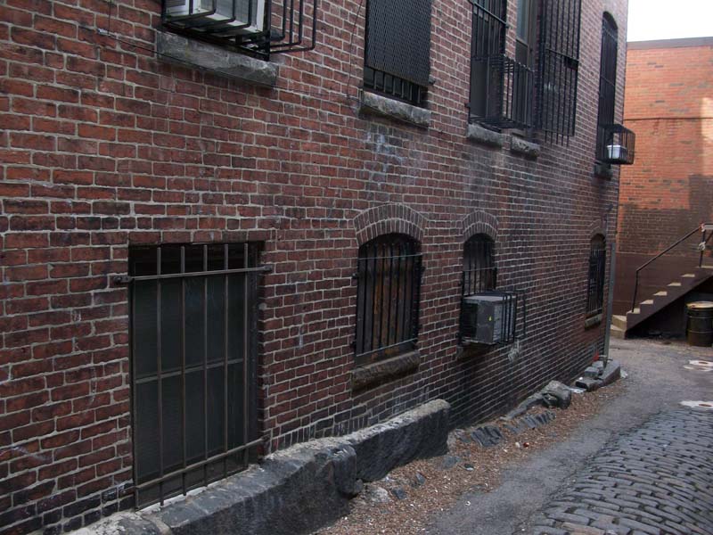
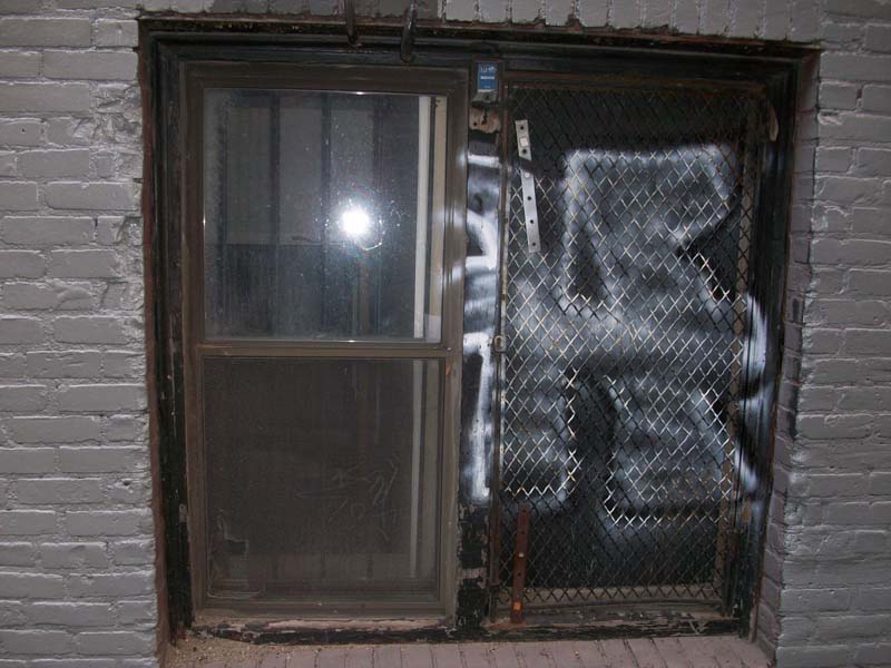
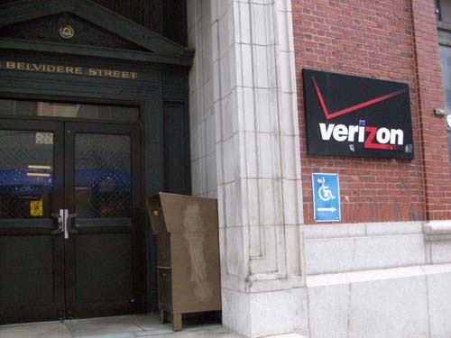
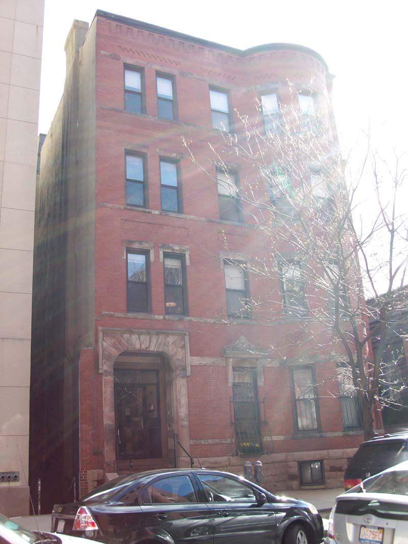
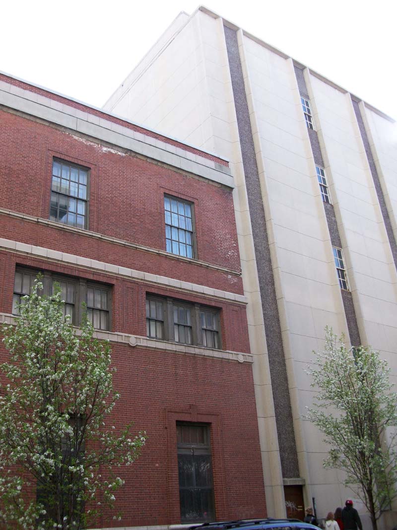
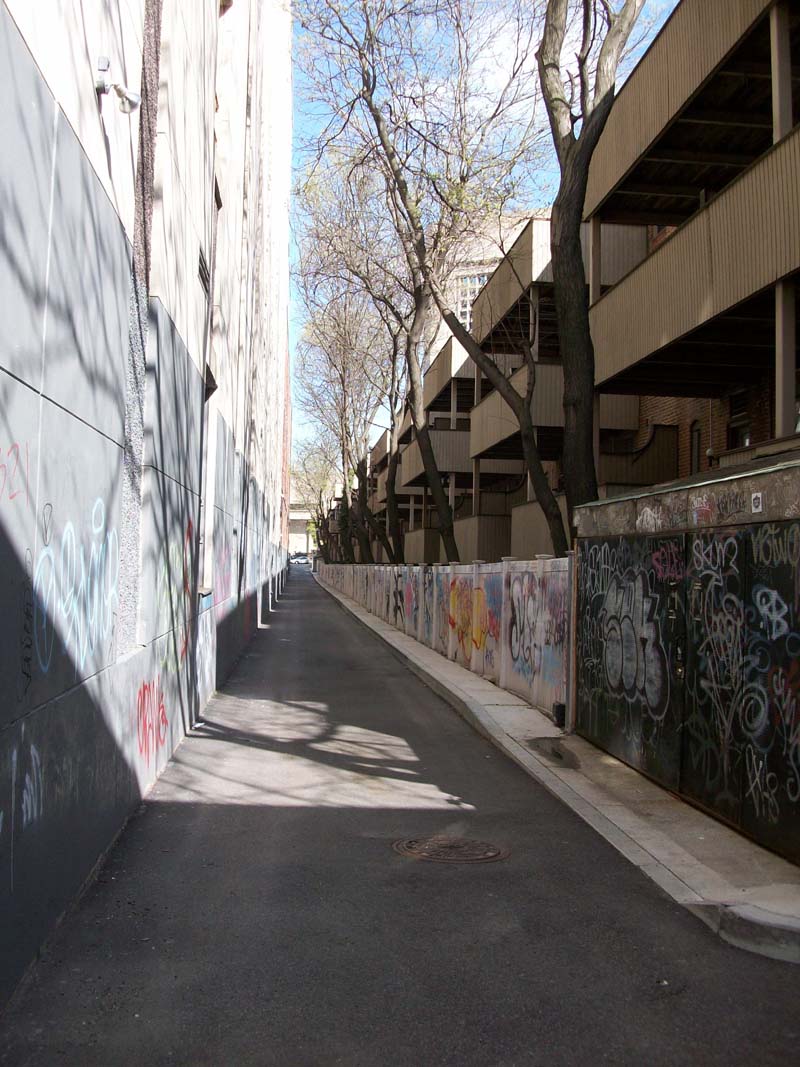
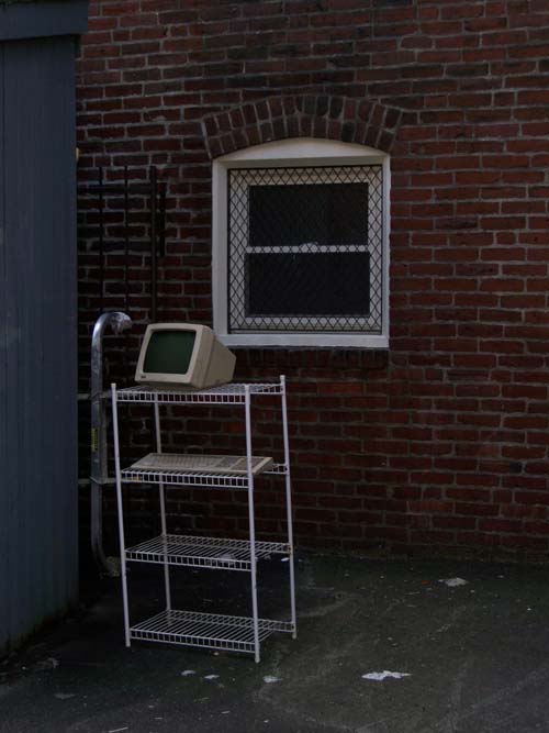
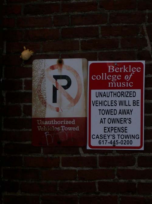
Going past St. Cecilia Street, the 1937 Sanborn map shows a row composed of flats, the New England Telephone and Telegraph Company, and apartments until the end of the street. This portion of Belvidere Street looks slightly different today. Some of the flats have remained and are still inhabited by residents, at least so indicate the front entrances of the buildings. Some balconies have plants growing in pots, while others have a small flower garden. However, the row of flats is disrupted by another “alley” which is not present on the 1937 map which is composed of a set of stairs that lead to the back-door entrance of these flats. This gap between flats was probably created decades after the original flats were built when the current adjacent building was built. It seems that a part of the flats was torn down in more recent times to build an extension to a Verizon building that would be joined with the old telecommunications company. This conclusion is drawn from the fact that the current buildings labeled “Verizon” cover a much larger area than the old telecommunications company from 1937 and the building material looks like concrete and not red brick, hence its modern artifact. Whenever I would walk around on site, I assumed that the Verizon building located in the old telecommunications company was deserted since some of its windows were broken, there were no blinds, and the entrance looks very poorly maintained. However when taking photographs of the building for this assignment, three women walked out of the building, and when I tried to enter it they locked the door and prevented me from entering saying that it was a private Verizon building not open for the public and they refused to elaborate any further. Access to the premise requires scanning a card and/or entering a passcode, which probably means that it could be a Verizon customers’ service office or telemarketing center.


stairs leading to the back row of Belvidere Street, the gap between buildings was created when some of the old
flats were torn down and replaced with a new Verizon building, the gap is not present in old maps


poorly maintained front entrance of the Verizon building, deserted drawer set near the door!


sign on the new building verifying that this is indeed private property owned by Verizon


first building that housed flats, notice gap and concrete structure (new Verizon building), also flower pot on the first floor as a sign of residents


the new Verizon building (white) next to the old telecommunications company building (red brick), notice the overlapping structures at the top,
indicating that the concrete building replaced an old brick building

The old Sanborn map shows apartments past the telecommunications company, however today there is no sign of these apartments. Instead, there is a large parking lot at the end of the street in which residents of other apartments and workers in the Verizon building or the Christian Science administrative building can park their vehicles. There is also a large patch of greenery next to the parking lot at the intersection with Dalton Street in front of the Hilton and Sheraton Hotels in order to beautify an area that seems to be almost entirely deserted to the casual passerby and especially the hotel guests. The sidewalks along the street are all paved and tiled as opposed to the unpaved alley street, a sign of some development occurring on the street.


parking lot at the end of Belvidere Street which replaced old apartments

St. Germain Street

The history of St. Germain Street is also best represented through the Sanborn map of 1937 since it encompasses all the buildings that occupied the entire street. On its left and right, the map shows rows of flats and apartments along the stretch of the street. Today, most of these flats remain, with slight changes in their appearance and usage. At the northern strip of the street, a general trend seems apparent with the flats. New balconies made of wood were added to the buildings perhaps to persuade people to live in these flats. The flats on St. Germain Street are also the only ones surrounded by a wall that acts as a gate that separates them from parallel rows of flats on Belvidere Street. This wall is entirely covered in graffiti indicating that young adults or children are the residents and/or frequent visitors of these flats, as opposed to the early 1900s when the residents were single families. Another trace from the past are the allies that separate the rows of buildings. Unlike the streets in the surrounding area, they are narrow and hence can only fit one car and accommodate single-way traffic, which probably was the case a century ago with the limitations of old automobiles and their general frowned upon use in residential areas. The alley streets are also unpaved and very poorly maintained as the street is not level. The apartments at the end of St. Germain Street were also destroyed at one point since they are now replaced with the parking lot and grass.


newly added balconies on old flats at the northern strip of St. Germain Street, graffiti that plagues the narrow allies, walls acting as gate to seal off
residents of these flats

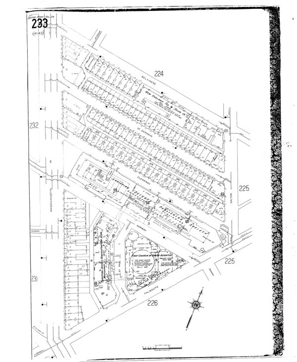
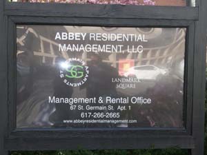
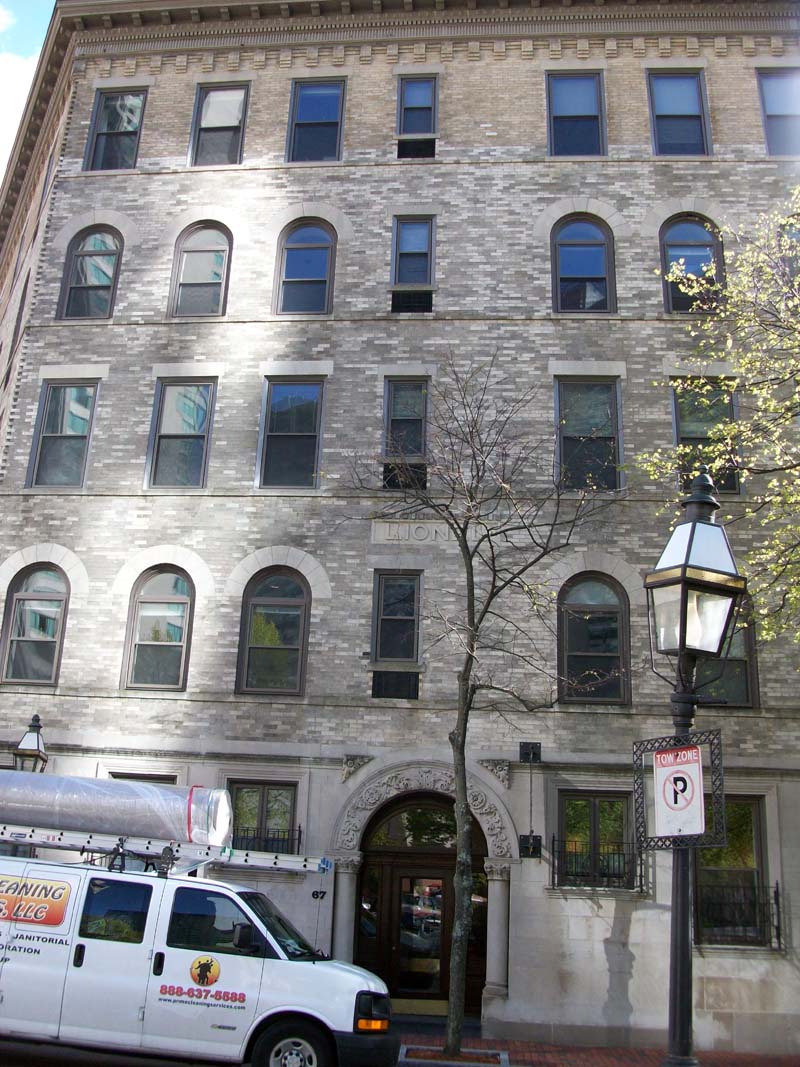
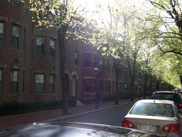
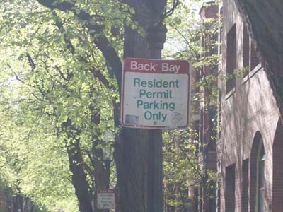
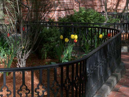
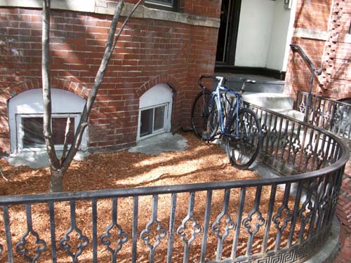
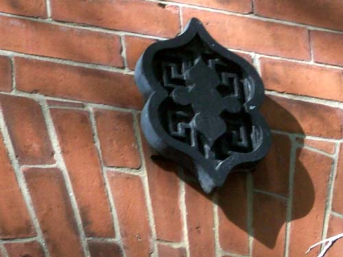
The southern strip of flats that lie along St. Germain Street is much better maintained and appealing to the eyes. The first building to notice is the only building that is different in appearance and style to the rest of the flats. Its first floor is made of concrete and has small windows, whereas the upper floors are made of brick and were perhaps painted white in order to create a homogenous appearance. This building may have once been a residential building, yet today it is home to the Abbey Residential Management, a company which manages apartment rental on St. Germain Street and is part of the St. Germain Apartments group. It is difficult to imagine such a company existing in the area in the early 1900s, since these dense apartments and flats were aimed at a certain class of people, the middle-to-low income families. However, today St. Germain Street is a different place, yet still retains some of its old attributes. The brick buildings are all uniform in appearance, and steel enclosed front-yards were probably added much later as an attempt to make the area more attractive. The street is much wider indicating that traffic flow is heavier; the sidewalks are made of red brick, a layer from the past which has remained in use. These flats are also the only ones advertised as being a part of the Back Bay neighborhood which tells a lot about the direction the neighborhood and possibly the rest of the area are headed. Unlike the early 1900s, the Back Bay neighborhood today is one of the most desired locations in the city and so development in the area is aimed at attracting more middle-to-upper income residents. Some buildings however are still deserted or undergoing renovation, and there are still alleys of similar features to the ones on Belvidere Street that serve as a reminder of a less prestigious past. Another layer that was added to all the buildings is a metallic sign that perhaps signals that these buildings are all under the management of a single company, thereby creating a neighborhood community.


the Abbey Residential Management group which manages rentals on the southern strip of St. Germain Street

rows of prestigious flats on St. Germain street and a sign stating the street as part of the Back Bay area with parking being available to residents only, highlighting the exclusiveness of the location


the steel protected front yard was an added layer to all buildings, these pictures show more signs of life in the apartments, a tulip garden and bicycle


the metal object that is found above the entrance level on all buildings on St. Germain Street

Clearway Street

The apartments and flats on Clearway Street have remained largely the same. No changes have been made to their usage since 1937 as per the Sanborn map. The buildings are all red brick and uniform in appearance. New wooden balconies were also added more recently to most flats in which people reside. Some of the buildings are completely deserted, their windows broken, their entrances vandalized, others seem deserted but are actually partly occupied since there are blinds and sometimes people can be seen through the windows. Other buildings, mostly the ones with balconies, are completely occupied, yet their residents are not middle-to-low income single families, but young adults, and more specifically university students. Along the streets there are signs that say “Berklee College of Music”, indicating that the college bought the land on the street and is renting out the apartments to students, or possibly might turn some of the unoccupied buildings into dormitories in the future. The street is also narrow and large garbage cans are at the front-door entrance of these apartments (unlike St. Germain Street and Belvidere Street where the trash was disposed of at the back), a trend from the past since the area was for low-income families and aesthetic appearance was not a main concern of many residents back then, and would not be today if the majority of residents were university students who tend not to be concerned with such matters. A recurring theme in the streets that house flats and apartments on site is the disappearance of these buildings at the end of the streets, for one reason or another. On Clearway Street the end of the street is cleared and the street is elevated to form a wide ramp, possibly to accommodate the garbage pick-up trucks that would have to park somewhere, since the street is not close to the parking lot and is too narrow for trucks to pass through. Another possible reason for this is that Belvidere Street and St. Germain Street were elevated through time, hence the paved roads and well-maintained sidewalks, yet Clearway Street wasn’t because possibly there were few residents in the buildings before Berklee College bought the land, and so a ramp was built to connect the street with the rest of the area. Admittedly the second assumption is far-fetched and can be refuted by the presence of the red brick sidewalks on St. Germain Street which are probably as old as the street itself; however it is a hypothesis which unfortunately due to the lack of any other traces or layers on the street cannot be rightfully verified or refuted.


apartments on Clearway Street, garbage bins at the front entrance of many old buildings


deserted objects next to old deserted unoccupied buildings on Clearway Street (left), sign claiming ownership of property to the Berklee College of Music (right)

Norway Street, St. Paul Street, and Falmouth Street

These three streets as per various Sanborn maps were at the heart of Christian Science. Today however, they are off limits to street vehicles and instead are open to pedestrians and service vehicles that tend to the Christian Science Center. Since these streets allowed access to the Church, it is fair to assume that they have retained their width and overall size over time. Norway Street has retained a trace from the past in its paved streets and lack of any sidewalks, since the street did not connect residence flats to the church. It is difficult to tell what the exact borders of St. Paul street were since today it is replaced by a curved semi-circular track after the Christian Science Administration Building and the residential flats on Massachusetts Avenue were destroyed and replaced with greenery. However, there are changes in ground material that might be an artifact of the past. The current space that used to be St. Paul Street was covered with red brick ground, except for a single strip which remained paved road material, perhaps the area where the street sidewalk was. Falmouth Street today is part of the rectangular area that borders the reflecting pool and splash fountain. This area once was home to the Brookline Hotel in the later 19th century, however the hotel was entirely replaced by the church’s domed extension in the early 20th century and so no apparent traces remain. As is the case with St. Paul Street, the width of Falmouth Street can be determined by the change in ground material from red brick to a paved street and red brick again, etc…


the old Norway Street which used to be accessible to street cars heading towards the church, the paved street
and brick ground separate the old Norway Street from the old Falmouth Street


the old St. Paul Street bordering the domed extension, the patch of tiled ground was probably the old street
sidewalk, hence the actual width of the street can be determined


the old Falmouth Street, currently it is all made of brick as opposed to the paved road material which it was
made of in earlier times, the two rows of tiles on both ends of the "street" were also probably old street sidewalks
and hence help determine what its "real" boundaries were back then

Massachusetts Avenue

There was a point in time when Massachusetts Avenue was home to a row of flats, apartments, and the Massachusetts Horticultural Hall (Sanborn 1914). Today however, none of these buildings are present, and instead of the flats there is a large green open space for public amusement. The Horticultural hall moved south of its previous location, and its old building is currently occupied by the Boston Magazine. This can be inferred from the red brick that makes up that building since it probably is the same brick that made up the flats and hence was used for uniformity on the street.


the old Massachusetts Horticultural Hall turned into the Boston Magazine building


this area used to house more flats (green grass now) and the Christian Science Administrative building (empty/brick)

Huntington Avenue

Huntington Avenue was home to French flats, a park, and the St. James Theater as per the 1914 Sanborn map. None of these buildings remain today. Instead of the flats and park, there is a reflecting pool and splash fountain. Traces of the park can be seen through the fertile soil in which the plants on the sidewalks of Huntington Avenue are grown. The theater was replaced by the Christian Science Sunday School in 1971 and is not housed in the same building, since the new building is not rectangular in shape, but semi-circular, and is nowhere near as big as the old theater building since space had to be cleared for the pool and fountain. The flats were later replaced by the fountain and sidewalk, and perhaps the same pipes that were used to deliver water to the flats are used to operate the pool and water the trees along the sidewalk, since there isn’t an apparent source of water above the ground.


incadescent light bulbs added after the original building was built, the current Sunday school which used to be
the St. James Theater at the far left end of the photograph


the reflecting pool, its sides made of marble, is an added layer to where the park on Huntington Avenue was


the splash fountain where several flats used to be, perhaps the same pipes are still used in water circulation

Conclusion

The site has undergone several transformations over the past century, some of which so severe that it is difficult to recognize it as being the same place across different historic maps. Despite these changes however, it has retained some of its most basic qualities whether through the remaining flats, the unchanged original church and domed extension, the publishing society and library building, or the way some people still utilize these buildings and the site overall. Some changes on site have left behind indiscernible traces of decades past; others are much more visible through the design artifacts or even the dates that leave a mark of identification on some buildings. Regardless of the past however, the present and future of the site seem to be headed in one direction: development. The site which started out as a multi-use area has remained institutional for a long time. In more recent years, it seems that more efforts have gone into reviving certain parts on site to draw in more businesses, customers, and residents. The efforts that began with the creation of the plaza in the 1960s to draw in more visitors and tourists have continued until this very day in other aspects. The renovation that took place on St. Germain Street or the purchase of property on Clearway Street by Berklee College are both successful examples of residential development. The Boston Magazine building on Massachusetts Avenue and the McDonald’s branch on Belvidere Street are evident efforts towards business development. Coupled with its amenities from the past and vision of the future, it is my belief that the site will continue to expand future development until every building on every block is utilized to its utmost extent.


trees where flats used to be along Huntington Avenue, possibly also watered with the same pipes; benches and ledges added much later when the plaza was built; red brick ground might have been an old sidewalks in front of the flats


the original church and domed extension which replaced the old Hotel Brookline, different design features were
employed in both structures, the free-standing street lights around the plaza certainly installed much later

-all photos were taken by the author, unless states otherwise
-sources used:
Jane Jacobs "The Death and Life of Great American Cities"
Sanborn fire insurance maps
Material from in-class lecture by Prof. Anne Whiston Spirn
Dima Ayyash 4.211J-11.106J Spring 2010